Category:David Rumsey Historical Map Collection
Jump to navigation
Jump to search
one of the world's largest private map collections | |||||
| Upload media | |||||
| Instance of |
| ||||
|---|---|---|---|---|---|
| Location | David Rumsey Map Center, Stanford, Santa Clara County, California, Pacific States Region | ||||
| Founded by |
| ||||
| official website | |||||
| |||||
The David Rumsey Historical Map Collection is one of the world's largest private map collections. It has some 150,000 maps and cartographic items. The collection was created by David Rumsey, who after making his fortune in real estate, focused on collecting eighteenth- and nineteenth-century North and South America as this era "saw the rise of modern cartography. Web site: www.davidrumsey.com.
Subcategories
This category has the following 95 subcategories, out of 95 total.
1
- 1747 Persia map by Emanuel Bowen (22 F)
- 1811 map of Turkey by Darton (30 F)
A
- Atlas de Chile, 1903 (44 F)
- Atlas de Colombia, 1827 (13 F)
- Atlas der Alpenländer, 1874 (13 F)
- Atlas of Oblique Maps (5 F)
- Atlas of World Maps (28 F)
- Atlas von Asien (32 F)
- Atlas von China, 1885 (35 F)
B
- Black's Atlas of North America (27 F)
C
- Cartee's Physical Atlas (17 F)
E
- Edinburgh cabinet atlas (56 F)
F
H
- Hand Atlas, 1881 (126 F)
- Historical Atlas (Quin 1830) (9 F)
I
K
- Karte des Deutschen Reiches (8 P, 1395 F)
L
M
- Map of United States, 1890 (11 F)
- Modern atlas by Pinkerton, 1815 (68 F)
N
- Nippon (Siebold) (438 F)
O
P
R
S
T
- The World Atlas (1967) (4 F)
- Topographic map of France, 1864 (34 F)
- Travels in the Air, 1871 (32 F)
U
Media in category "David Rumsey Historical Map Collection"
The following 200 files are in this category, out of 722 total.
(previous page) (next page)-
1701 Guillaume Delisle map of the Ottoman and Persian Empires (cropped).jpg 8,875 × 6,466; 50.25 MB
-
1701 Guillaume Delisle map of the Ottoman and Persian Empires (Nubia).jpg 1,782 × 1,838; 2.79 MB
-
1701 Guillaume Delisle map of the Ottoman and Persian Empires.jpg 7,617 × 5,774; 35.89 MB
-
1710 Nanyanbuzhou.jpg 8,567 × 7,024; 12.82 MB
-
1787 map of South America.jpg 15,730 × 6,866; 18.36 MB
-
1808 map of Turkey in Asia (cropped).jpg 5,633 × 4,244; 17.26 MB
-
1808 map of Turkey in Asia.jpg 7,025 × 5,841; 30.62 MB
-
1817 - Charles Smith - Comparative View of the Lengths of the Principal Rivers in the World.jpg 12,041 × 9,520; 18.41 MB
-
1828 - Charles Smith - Picture of Organized Nature as Extending over the Earth.jpg 15,213 × 7,045; 23.46 MB
-
1832 Erie Canal.jpg 4,205 × 938; 774 KB
-
1836 - Charles Smith& Son - A Comparative Picture of the Principal Waterfalls in the World.jpg 11,612 × 8,140; 22.01 MB
-
1837 - Thomas Moule - A comparative view of some of the principal hills in Great Britain.jpg 4,380 × 5,580; 7.82 MB
-
1846 Lewis's Post Town map of Ireland.jpg 8,478 × 10,669; 16.69 MB
-
1849 Railroad Map of New England & Eastern New York.jpg 7,882 × 9,884; 19.41 MB
-
1850 - James Reynolds & John Emslie - Buildings.jpg 5,350 × 4,270; 9.95 MB
-
1850 Atlas von Palaestina und der Sinai Halbinsel (composite of 15 sectional sheets).jpg 22,313 × 32,413; 53.78 MB
-
1851 - James Reynolds & John Emslie - Mountains.jpg 4,382 × 5,453; 4.63 MB
-
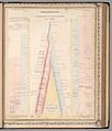
1851 - James Reynolds & John Emslie - Panoramic plan of the principal rivers and lakes.jpg 4,363 × 5,462; 5.23 MB
-
1851 Henry Warren Map of Syria (cropped).jpg 3,162 × 4,413; 12.73 MB
-
1851 Henry Warren Map of Syria.jpg 3,750 × 4,700; 15.66 MB
-
1855 Telegraph and Rail Road Map of the New England States.jpg 10,147 × 9,760; 21.05 MB
-
1856 chicago st. louis.jpg 5,152 × 4,316; 6.5 MB
-
1857 Blanchard's map of Chicago.jpg 7,248 × 9,100; 16.49 MB
-
1866 Northern California Map.jpg 3,000 × 2,955; 4.19 MB
-
1867 New Haven, Middletown and Boston Railroad map.jpg 8,479 × 7,920; 16.44 MB
-
1869 Blanchard's Guide Map of Chicago.jpg 4,902 × 6,376; 8.85 MB
-
1869 Blanchard's map of Chicago and Environs.jpg 5,120 × 6,279; 6.41 MB
-
1871 Boston map by H. F. Walling & Orm Gray.jpg 8,552 × 5,531; 14.07 MB
-
1871 chicago.jpg 3,164 × 5,184; 5.18 MB
-
1871 New England railroad map.jpg 4,772 × 6,252; 6.68 MB
-
1872 North German Confederation and Prussia map.jpg 8,551 × 6,679; 9.93 MB
-
1876 Chicago by Warner & Beers.jpg 4,053 × 5,158; 5.99 MB
-
1879 B&M cover.jpg 2,636 × 2,403; 1.3 MB
-
1879 B&M map.jpg 6,585 × 7,199; 11.21 MB
-
1879 B&M text.jpg 7,204 × 6,576; 12.94 MB
-
1879 CV cover.jpg 2,620 × 1,925; 1.67 MB
-
1879 CV excursion routes.jpg 3,288 × 3,991; 3.93 MB
-
1879 CV map only.jpg 1,860 × 2,688; 1.54 MB
-
1879 CV White Mountains.jpg 2,314 × 1,790; 1,017 KB
-
1879 CV.jpg 3,968 × 3,216; 3.19 MB
-
1879 Portland & Ogdensburg map only.jpg 2,995 × 2,004; 1.65 MB
-
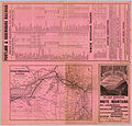
1879 Portland & Ogdensburg White Mountains.jpg 4,515 × 4,753; 5.68 MB
-
1879 Portland & Ogdensburg.jpg 4,717 × 4,517; 5.45 MB
-
Jouvet et Cie. Grece. Caucase et Crimee. 1882.jpg 3,859 × 5,268; 3.8 MB
-
1884 Chicago & Alton map only.jpg 2,796 × 1,910; 1.67 MB
-
1884 Chicago & Alton text.jpg 8,896 × 4,704; 11.92 MB
-
1884 Chicago & Alton.jpg 8,872 × 4,694; 12.58 MB
-
1885 ACL map.jpg 5,466 × 4,847; 7.84 MB
-
1885 ACL text.jpg 5,502 × 4,857; 6.87 MB
-
1885 Chicago & Alton map only.jpg 2,791 × 1,904; 1.72 MB
-
1885 Chicago & Alton text.jpg 8,912 × 4,720; 13.01 MB
-
1885 Chicago & Alton.jpg 8,910 × 4,760; 13.58 MB
-
1887 C> text.jpg 4,740 × 10,660; 10.17 MB
-
1887 C>.jpg 10,540 × 4,604; 11.34 MB
-
1887 Map of Chicago and Environs by Blanchard.jpg 9,360 × 12,541; 22.96 MB
-
1887 Montreal - Boston.jpg 5,147 × 9,309; 11.11 MB
-
1887 Wabash cover.jpg 2,380 × 2,316; 1.21 MB
-
1887 Wabash.jpg 4,177 × 2,308; 2.49 MB
-
1888 B&M cover.jpg 2,368 × 2,493; 1.32 MB
-
1888 B&M map.jpg 8,812 × 4,676; 12.7 MB
-
1888 B&M text.jpg 8,824 × 4,668; 12.9 MB
-
1888 Boston map showing proposed NY&B Rapid Transit route.jpg 8,672 × 10,761; 19.97 MB
-
1893 New Haven east.jpg 5,747 × 5,719; 5.05 MB
-
1895 Ward 11 map detail of Atlas of the City of Boston by Bromley p9.jpg 11,442 × 7,452; 13.86 MB
-
1897 Brooklyn map.jpg 4,134 × 3,084; 4.48 MB
-
1897 Chicago railroads.jpg 6,065 × 8,173; 14.72 MB
-
1897 chicago vicinity.jpg 6,101 × 8,533; 15.21 MB
-
1903 Boston map.jpg 7,960 × 11,560; 25.49 MB
-
1903 Boston suburban railroads map.jpg 4,131 × 3,180; 4.47 MB
-
1910 GTP.jpg 8,080 × 10,186; 19.79 MB
-
1918 NYCRR cover.jpg 2,712 × 3,041; 2.81 MB
-
1918 NYCRR Grand Central.jpg 5,216 × 3,032; 4.61 MB
-
1918 NYCRR Manhattan.jpg 6,310 × 10,991; 17.89 MB
-
1918 NYCRR map only.jpg 4,692 × 2,600; 4.01 MB
-
1918 NYCRR.jpg 6,100 × 10,684; 15.89 MB
-
1927 New York Central Railroad map.jpg 7,579 × 4,582; 9.33 MB
-
3 years of war, 1944.jpg 5,477 × 3,852; 7.37 MB
-
A Map Of The State Of Pennsylvania by Reading Howell, 1792 crop1.png 900 × 675; 1.15 MB
-
A Map Of The State Of Pennsylvania by Reading Howell, 1792.jpg 9,730 × 5,719; 48.11 MB
-
A medieval map of east and west.jpg 5,238 × 3,767; 4.8 MB
-
AcreNE1799.jpg 1,065 × 721; 291 KB
-
Adams Synchronological Chart, 1881 (cropped).jpg 2,149 × 2,188; 754 KB
-
Adams Synchronological Chart, 1881.jpg 40,445 × 4,309; 44.13 MB
-
Admiralty Chart No 2657 Gulf of Tokyo or Yedo, Published 1881.jpg 8,426 × 12,228; 31.14 MB
-
Admiralty Chart No 2806 Charleston Harbour, Published 1869.jpg 12,102 × 8,258; 15.84 MB
-
Admiralty Chart No 533 Georgetown and Mouths of Demerara & Essequibo Rivers, Published 1872.jpg 12,195 × 8,214; 27.9 MB
-
Admiralty Chart No 591 Habour of San Francisco, Published 1833 (cropped).jpg 6,265 × 7,431; 10.25 MB
-
Admiralty Chart No 591 Habour of San Francisco, Published 1833.jpg 13,286 × 9,354; 22.7 MB
-
Adolf Stieler, Frankreich in 4 Blattern, 1873 - David Rumsey.jpg 9,456 × 7,544; 14.92 MB
-
Adolf Stieler, Frankreich In 4 Blattern. Blatt 3, 1875 - David Rumsey.jpg 11,936 × 9,308; 24.79 MB
-
Adolf Stieler, Sudwestliches Frankreich, 1866 - David Rumsey.jpg 10,314 × 7,597; 16.48 MB
-
Air map of the World, 1943.jpg 2,810 × 1,890; 2.59 MB
-
Alaska pictorial.jpg 1,354 × 647; 493 KB
-
Alexandria Winchester 1794.jpg 914 × 572; 192 KB
-
Allgemeine Welt-Karte, 1811.jpg 5,059 × 5,327; 6.17 MB
-
America Settentrionale E Meridionale, 1856.jpg 4,616 × 3,261; 2.63 MB
-
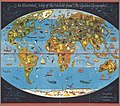
An Illustrated Map of the World from The Golden Geography, 1952.jpg 2,076 × 1,834; 818 KB
-
Arab League, 1946.jpg 5,467 × 3,859; 6.16 MB
-
Arctic arena of the World War II.jpg 1,675 × 2,144; 712 KB
-
Arctic ice March 1946 20%.jpg 9,375 × 9,200; 3.24 MB
-
Arctic ice October 1946 20%.jpg 9,375 × 9,200; 3.36 MB
-
Arizona 1909.jpg 4,601 × 5,504; 4.65 MB
-
Arroe by Blaeu 1665 (cropped).jpg 3,745 × 2,404; 5.73 MB
-
Arroe by Blaeu 1665.jpg 9,054 × 6,705; 7.35 MB
-
Arrowsmith - Colonial Mexico and Caribbean.jpg 22,158 × 14,179; 56.34 MB
-
Austrian Empire (Arrowsmith, 1842 - part 1).jpg 9,200 × 7,522; 16.38 MB
-
Austrian Empire (Arrowsmith, 1842 - part 2, Kingdom of Lombardy–Venetia).jpg 9,200 × 7,640; 15.98 MB
-
Austrian Empire (Dower, 1844).jpg 7,257 × 5,944; 6.71 MB
-
Austrian Empire (Dufour, 1863).jpg 9,282 × 6,945; 11.04 MB
-
Austrian Empire (Gaspari, 1817).jpg 9,227 × 7,665; 13.77 MB
-
Austrian Empire (Hall, 1828).jpg 6,536 × 5,369; 7.74 MB
-
Austrian Empire (Johnston, 1861).jpg 10,500 × 7,081; 15.01 MB
-
Austrian Empire (Weiland, 1836).jpg 10,143 × 7,977; 16.18 MB
-
Austrian Empire, composite map (Johnston, 1861).jpg 9,900 × 6,677; 14.68 MB
-
Austro-Hungarian Monarchy, composite map (Johnston, 1879).jpg 9,800 × 6,552; 14.1 MB
-
Austro-Hungarian Monarchy, composite map (Johnston, 1893).jpg 9,800 × 6,528; 12.98 MB
-
Battle of Bentonville map.png 1,920 × 1,718; 1.82 MB
-
Battle of Front Royal map.png 1,614 × 1,609; 1.5 MB
-
Battle of Mobile Bay map.png 1,000 × 1,428; 1.02 MB
-
Battle of Pea Ridge 1.png 2,000 × 1,462; 2.03 MB
-
Battle of the Wilderness 1864 map.png 2,355 × 1,519; 2.43 MB
-
Bavariae by Johann Baptist Homann 1752.jpg 9,390 × 11,769; 52.71 MB
-
Belgien1844.png 1,455 × 878; 2.84 MB
-
Belgium, old map.jpg 4,798 × 4,189; 3.82 MB
-
Bellin, Jacques Nicolas. Plan De La Rade De St. Jean D'Acre a la Coste de Syrie. 1764.jpg 3,191 × 4,121; 2.43 MB
-
Blatt 35 Amrum Karte des Deutschen Reiches 100000.jpg 10,621 × 9,278; 11.71 MB
-
Blatt 54 Die Schweiz.jpg 11,758 × 9,664; 67.27 MB
-
Bombay Presidency (1832).jpg 6,197 × 4,436; 10.13 MB
-
Boston and maine rr bridge saco 1879.jpg 1,727 × 1,154; 1.87 MB
-
Bourgoin, Pierre — Mappe Monde Carte Universelle 1766.jpg 2,318 × 1,500; 537 KB
-
Bowen, Emanuel. Anatolia, Syria. 1747 (D).jpg 894 × 438; 82 KB
-
Bowen, Emanuel. Anatolia, Syria. 1747. (A).jpg 4,075 × 3,311; 3.73 MB
-
Bowen, Emanuel. Anatolia, Syria. 1747. (B).jpg 1,302 × 1,507; 602 KB
-
Bowen, Emanuel. Anatolia, Syria. 1747. (C).jpg 1,302 × 1,215; 477 KB
-
Bowen, Emanuel. Anatolia, Syria. 1747.jpg 5,852 × 4,312; 4.64 MB
-
Bowen, Emanuel; Orbeliani, Sulxan-Saba. A new and accurate map of the Caspian Sea. 1747.jpg 2,906 × 4,220; 2.05 MB
-
Brasões históricos de Portugal (L'Atlas Historique, Tome 7).jpg 2,107 × 1,481; 710 KB
-
Brussels 1837 Saint Gaugericus.jpg 1,362 × 1,128; 439 KB
-
Brussels 1837.jpeg 7,150 × 6,225; 10.69 MB
-
CalGoldRushMap.jpg 1,416 × 1,796; 1.18 MB
-
Canaan Aram. John Melish. The Places Recorded in the Five Books of Moses. 1815.jpg 1,755 × 1,372; 1.67 MB
-
Canada and Newfoundland, their natural and industrial resources.jpg 15,020 × 10,244; 26.93 MB
-
Canada pictorial.jpg 3,026 × 1,919; 2.88 MB
-
Carta general de la República Mexicana (Debray, 1867).jpg 13,929 × 9,437; 21.82 MB
-
Carte de l'Empire d'Alemagne (Rizzi Zannoni, 1780).jpg 9,900 × 6,246; 14.26 MB
-
Carte de l'Empire d'Allemagne divisé en ses dix cercles (Vaugondy, 1756).jpg 7,069 × 6,139; 10.93 MB
-
Carte de l'Empire Espagnol dans les deux Ameriques, 1873.jpg 4,100 × 5,650; 4.05 MB
-
Carte de l'Empire Français 1812.jpg 9,338 × 6,938; 22.19 MB
-
Carte de la France avec ses établissements politiques, militaires, civils et religieux (15521001).jpg 30,252 × 20,234; 170.67 MB
-
Carte des Indes Orientales, 1665.jpg 4,091 × 2,884; 3.96 MB
-
Carte des routes de postes de l'Empire français (10914002).jpg 34,911 × 29,761; 251.46 MB
-
Carte Generale de l'Empire Chinois et du Japon.png 6,245 × 4,612; 43.36 MB
-
Carte generale de la Turquie d'Asie (1822).jpg 7,824 × 6,218; 38.77 MB
-
Carte géometrique de la France, par Cassini, Paris (0134002), edit.jpg 22,452 × 14,484; 230.25 MB
-
Carte géometrique de la France, par Cassini, Paris (0134002).jpg 22,452 × 14,484; 114.65 MB
-
Carte géometrique de la France, par Cassini, Paris (15504002), edit.jpg 21,687 × 13,825; 209.6 MB
-
Carte géometrique de la France, par Cassini, Paris (15504002).jpg 22,038 × 14,288; 103.3 MB
-
Carte Statistique de L'Allemagne (Mentelle-Poirson, 1803).jpg 7,628 × 6,788; 8.31 MB
-
Chile.1835.djvu 4,906 × 5,696; 3.56 MB
-
Chile.1838.djvu 7,150 × 6,225; 5.65 MB
-
Chile.1855.djvu 7,863 × 6,388; 4.74 MB
-
Chile.1862.djvu 4,312 × 5,819; 4.3 MB
-
Chile.1873.djvu 8,200 × 11,300; 13.88 MB
-
China - political (1922).jpg 9,344 × 7,284; 16.04 MB
-
Circulus Bavaricus-1688 (Rumsey).jpg 4,716 × 4,070; 7.31 MB
-
City of Berlin Letts's popular atlas 1883.jpg 6,078 × 4,907; 18.1 MB
-
City of Calcutta (10403000).jpg 26,784 × 30,832; 306.51 MB
-
City of Calcutta by Survey of India 1912.png 11,430 × 13,157; 66.89 MB
-
Civitates Orbis Terrarum Basel.jpg 6,850 × 5,730; 30.55 MB
-
Composite, A Sketch of the Countries between Jerusalem and Aleppo.jpg 7,830 × 11,810; 12.92 MB
-
Composite. Europaischen Russland. 1855. (A).jpg 1,811 × 1,250; 702 KB
-
Composite. Europaischen Russland. 1855. (B).jpg 934 × 627; 276 KB
-
Composite. Europaischen Russland. 1855. (C).jpg 756 × 348; 128 KB
-
Composite. Europaischen Russland. 1855. (D).jpg 2,290 × 1,694; 1.09 MB
-
Composite. Europaischen Russland. 1855. (E).jpg 967 × 984; 296 KB
-
Composite. Europaischen Russland. 1855.jpg 5,351 × 6,367; 7.21 MB
-
Continentem Dudum Notam Componebat (with) Continentem Noviter Detectam, 1660.jpg 5,087 × 3,164; 4.53 MB
-
Cook, James — 1773 Map of Charles Town.jpg 1,366 × 1,600; 670 KB
-
Cook, James — Map of the Province of South Carolina 1773.jpg 9,968 × 9,824; 22.85 MB
-
Coromandel Coast 1753.jpg 3,070 × 5,870; 3.62 MB
-
Cosmo Series world map, 1962.jpg 5,329 × 3,443; 6.43 MB
-
Covens et Mortier, Le plan de Paris, ses faubourgs et ses environs, 1742 - David Rumsey.jpg 9,691 × 7,326; 32.54 MB
-
Covens et Mortier; Lisle, Guillaume de. 2. pte. Crimee, Mer Noire. 1742 (A).jpg 3,689 × 2,993; 2.12 MB
-
Covens et Mortier; Lisle, Guillaume de. 2. pte. Crimee, Mer Noire. 1742 (B).jpg 1,773 × 2,539; 760 KB
.jpg/120px-%22Fimbriae_vulgo_Femeren_delineatio_geometrica_%21_authore_Iohanne_Mejero_%22_(22065114340).jpg)
.jpg/120px-1701_Guillaume_Delisle_map_of_the_Ottoman_and_Persian_Empires_(cropped).jpg)
.jpg/116px-1701_Guillaume_Delisle_map_of_the_Ottoman_and_Persian_Empires_(Nubia).jpg)


.jpg/120px-1808_map_of_Turkey_in_Asia_(cropped).jpg)




.jpg/82px-1850_Atlas_von_Palaestina_und_der_Sinai_Halbinsel_(composite_of_15_sectional_sheets).jpg)


.jpg/86px-1851_Henry_Warren_Map_of_Syria_(cropped).jpg)






.jpg/118px-Adams_Synchronological_Chart%2C_1881_(cropped).jpg)


.jpg/101px-Admiralty_Chart_No_591_Habour_of_San_Francisco%2C_Published_1833_(cropped).jpg)






.jpg/120px-Arroe_by_Blaeu_1665_(cropped).jpg)


.jpg/120px-Austrian_Empire_(Arrowsmith%2C_1842_-_part_1).jpg)
.jpg/120px-Austrian_Empire_(Arrowsmith%2C_1842_-_part_2%2C_Kingdom_of_Lombardy–Venetia).jpg)
.jpg/120px-Austrian_Empire_(Dower%2C_1844).jpg)
.jpg/120px-Austrian_Empire_(Dufour%2C_1863).jpg)
.jpg/120px-Austrian_Empire_(Gaspari%2C_1817).jpg)
.jpg/120px-Austrian_Empire_(Hall%2C_1828).jpg)
.jpg/120px-Austrian_Empire_(Johnston%2C_1861).jpg)
.jpg/120px-Austrian_Empire_(Weiland%2C_1836).jpg)
.jpg/120px-Austrian_Empire%2C_composite_map_(Johnston%2C_1861).jpg)
.jpg/120px-Austro-Hungarian_Monarchy%2C_composite_map_(Johnston%2C_1879).jpg)
.jpg/120px-Austro-Hungarian_Monarchy%2C_composite_map_(Johnston%2C_1893).jpg)




.jpg/120px-Bombay_Presidency_(1832).jpg)


.jpg/120px-Bowen%2C_Emanuel._Anatolia%2C_Syria._1747_(D).jpg)
.jpg/120px-Bowen%2C_Emanuel._Anatolia%2C_Syria._1747._(A).jpg)
.jpg/104px-Bowen%2C_Emanuel._Anatolia%2C_Syria._1747._(B).jpg)
.jpg/120px-Bowen%2C_Emanuel._Anatolia%2C_Syria._1747._(C).jpg)


.jpg/120px-Brasões_históricos_de_Portugal_(L%27Atlas_Historique%2C_Tome_7).jpg)


.jpg/120px-Carta_general_de_la_República_Mexicana_(Debray%2C_1867).jpg)
.jpg/120px-Carte_de_l%27Empire_d%27Alemagne_(Rizzi_Zannoni%2C_1780).jpg)
.jpg/120px-Carte_de_l%27Empire_d%27Allemagne_divisé_en_ses_dix_cercles_(Vaugondy%2C_1756).jpg)


.jpg/120px-Carte_de_la_France_avec_ses_établissements_politiques%2C_militaires%2C_civils_et_religieux_(15521001).jpg)
.jpg/120px-Carte_de_La_Russie_D%27Europe_avec_ses_nouvelles_acquisitions_sur_la_Suede%2C_la_Pologne%2C_et_le_Caucase._Vivien_de_Saint-Martin%2C_Louis._1824._(A).jpg)
.jpg/120px-Carte_de_La_Russie_D%27Europe_avec_ses_nouvelles_acquisitions_sur_la_Suede%2C_la_Pologne%2C_et_le_Caucase._Vivien_de_Saint-Martin%2C_Louis._1824._(B).jpg)
.jpg/120px-Carte_de_La_Russie_D%27Europe_avec_ses_nouvelles_acquisitions_sur_la_Suede%2C_la_Pologne%2C_et_le_Caucase._Vivien_de_Saint-Martin%2C_Louis._1824._(C).jpg)
.jpg/120px-Carte_de_La_Russie_D%27Europe_avec_ses_nouvelles_acquisitions_sur_la_Suede%2C_la_Pologne%2C_et_le_Caucase._Vivien_de_Saint-Martin%2C_Louis._1824._(D).jpg)
.jpg/101px-Carte_de_La_Russie_D%27Europe_avec_ses_nouvelles_acquisitions_sur_la_Suede%2C_la_Pologne%2C_et_le_Caucase._Vivien_de_Saint-Martin%2C_Louis._1824._(E).jpg)


.jpg/120px-Carte_des_pavillons_accompagnee_d%27observations_pour_en_faire_comprende_le_blazon_et_les_differentes_devises_(Suplement_a_l%27atlas_historique%2C_tome_7.%2C_No.43).jpg)
.jpg/120px-Carte_des_routes_de_postes_de_l%27Empire_français_(10914002).jpg)


.jpg/120px-Carte_generale_de_la_Turquie_d%27Asie_(1822).jpg)
%2C_edit.jpg/120px-Carte_géometrique_de_la_France%2C_par_Cassini%2C_Paris_(0134002)%2C_edit.jpg)
.jpg/120px-Carte_géometrique_de_la_France%2C_par_Cassini%2C_Paris_(0134002).jpg)
%2C_edit.jpg/120px-Carte_géometrique_de_la_France%2C_par_Cassini%2C_Paris_(15504002)%2C_edit.jpg)
.jpg/120px-Carte_géometrique_de_la_France%2C_par_Cassini%2C_Paris_(15504002).jpg)
.jpg/120px-Carte_Statistique_de_L%27Allemagne_(Mentelle-Poirson%2C_1803).jpg)



.jpg/120px-China_-_political_(1922).jpg)
.jpg/120px-Circulus_Bavaricus-1688_(Rumsey).jpg)

.jpg/104px-City_of_Calcutta_(10403000).jpg)


_Bay_of_Burgas.jpg/120px-Colton%2C_G.W._Turkey_In_Asia_And_The_Caucasian_Provinces_Of_Russia._1856_(E)_Bay_of_Burgas.jpg)

.jpg/120px-Composite._Europaischen_Russland._1855._(A).jpg)
.jpg/120px-Composite._Europaischen_Russland._1855._(B).jpg)
.jpg/120px-Composite._Europaischen_Russland._1855._(C).jpg)
.jpg/120px-Composite._Europaischen_Russland._1855._(D).jpg)
.jpg/118px-Composite._Europaischen_Russland._1855._(E).jpg)

_Continentem_Noviter_Detectam%2C_1660.jpg/120px-Continentem_Dudum_Notam_Componebat_(with)_Continentem_Noviter_Detectam%2C_1660.jpg)


.jpg/120px-Covens_et_Mortier%3B_Lisle%2C_Guillaume_de._2._pte._Crimee%2C_Mer_Noire._1742_(A).jpg)
.jpg/84px-Covens_et_Mortier%3B_Lisle%2C_Guillaume_de._2._pte._Crimee%2C_Mer_Noire._1742_(B).jpg)